About Leppävirta
HISTORY
Leppävirta became an independent perish in 1639. Before this, Leppävirta belonged to the Tavisalmi perish, which span across the Northern Savo region.
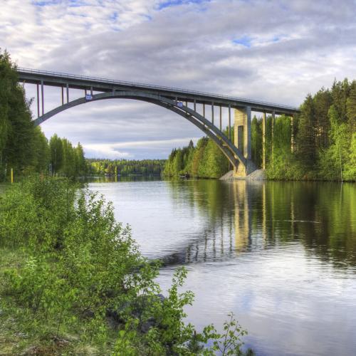
The naturally beautiful Leppävirta route has attracted travelers since the 1200s. Even in the present day, the route tends to both freight and personal transport through the Saimaa canal, all the way to the Gulf of Finland.
The location and the long industrial traditions of the region have allowed a wide range of businesses to be developed alongside the traditional farming and forest industries.
THE AREA
Leppävirta is located in Northern Savo, in the province of Eastern Finland, next to Highway 5 and the Saimaa waterway. The majority of the largest island in Finland, Soisalo belongs to Leppävirta.
Overall area 1 519,67 km2
land 1 136 km2
land owned by the municipality 3 293 ha
area belonging to the town plan 948 ha
water areas 384 km2
total length of coastline 2 250 km
area of town plan of coastlines 3 339 ha
partial areas of town plan of coastlines: Suvasvesi 240 km2, Unnukka 136 km2, Sorsavesi 66 km2
population density 9 people/km2 (in 2012)
(Information 1.1.2013, Source: Maanmittaushallitus/Pohjois-Savon liitto, kunnan maankäyttö- ja mittauspalvelut)

Distances from the center
Kuopio 54 km
Varkaus 24 km
Pieksämäki 50 km
Jyväskylä 130 km
Helsinki 340 km